File:Txu-oclc-10552568-nf49-2.jpg
預覽大小:789 × 599 像素。 其他解析度:316 × 240 像素 | 632 × 480 像素 | 1,011 × 768 像素 | 1,280 × 972 像素 | 2,560 × 1,945 像素 | 5,000 × 3,798 像素。
原始檔案 (5,000 × 3,798 像素,檔案大小:5.91 MB,MIME 類型:image/jpeg)
摘要
| 描述 |
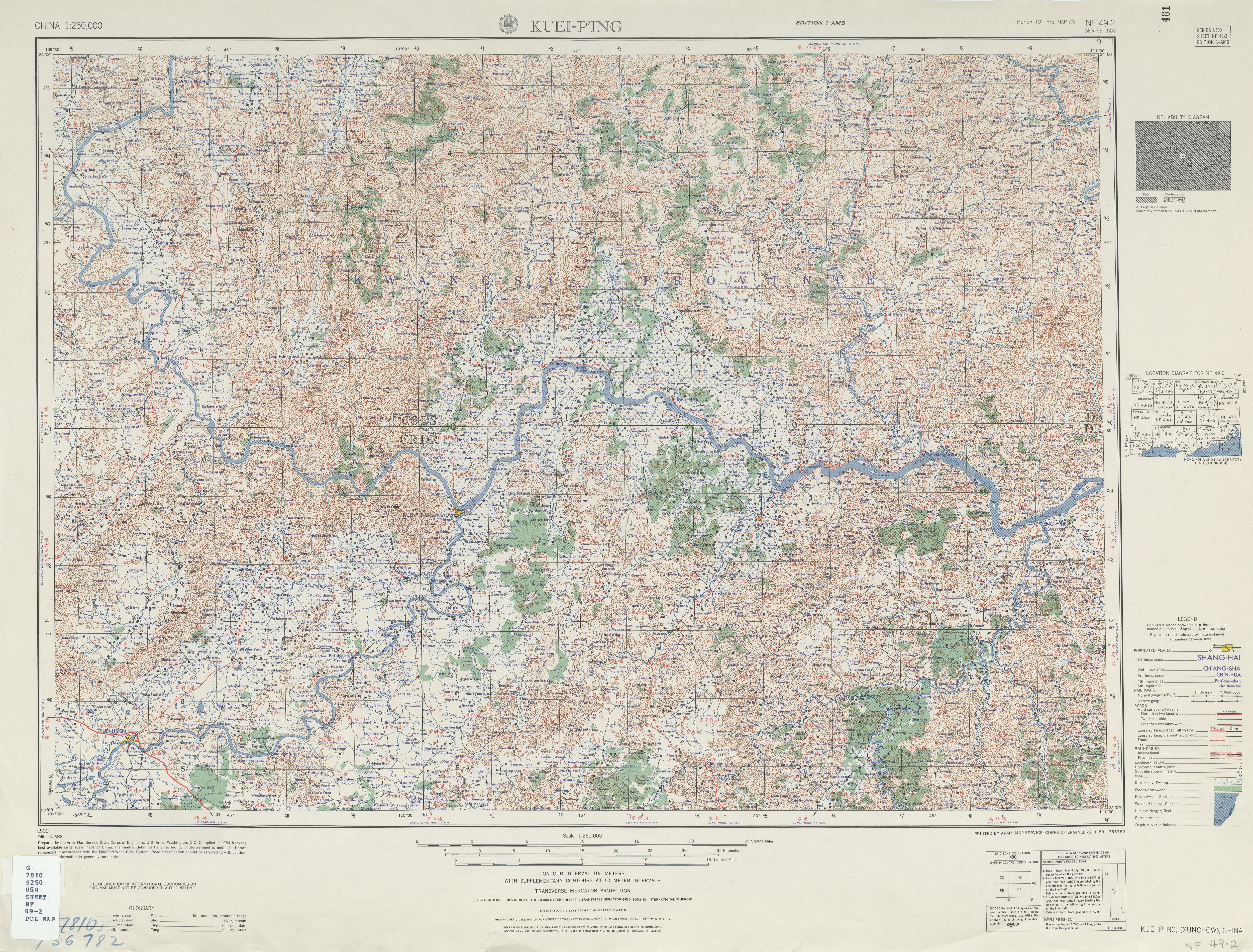
English: Map of Guiping (Kuei-p'ing, Sunchow) (桂平), Guizhou, China and surrounding region in China AMS Topographic Maps |
| 日期 |
Complied: 1954 Printed: January 1959 |
| 來源 | Courtesy of the University of Texas Libraries, The University of Texas at Austin. ([1]) |
| 作者 | Army Map Service, Corps of Engineers |
![[1]](https://web.archive.org/web/20190920092500/http://legacy.lib.utexas.edu/maps/ams/china/txu-oclc-10552568-nf49-2.jpg)
授權條款
This image or file is a work of a U.S. Army Corps of Engineers soldier or employee, taken or made as part of that person's official duties. As a work of the U.S. federal government, the image is in the public domain.
|
檔案歷史
點選日期/時間以檢視該時間的檔案版本。
| 日期/時間 | 縮圖 | 尺寸 | 使用者 | 備註 | |
|---|---|---|---|---|---|
| 目前 | 2019年9月13日 (五) 03:17 | | 5,000 × 3,798(5.91 MB) | Geographyinitiative | User created page with UploadWizard |
檔案用途
下列頁面有用到此檔案:
全域檔案使用狀況
以下其他 wiki 使用了這個檔案:
- en.wikipedia.org 的使用狀況
- en.wiktionary.org 的使用狀況